The Cultural and Historical Significance of Yarm on the River Tees
Yarm, North Yorkshire, is the kind of town where the landscape tells much of the story. Its attractive High Street, historic bridge, railway viaduct and position beside the River Tees are not simply picturesque features. Together, they reveal why Yarm became an important centre for trade, travel, transport and community life over many centuries.
Today, Yarm is widely appreciated for its historic character, independent shops, restaurants and riverside setting. Yet beneath its modern appeal is a much older story. The River Tees shaped where the town developed, how people travelled, what goods passed through it and why Yarm became an important stopping point between major settlements in northern England.
Understanding the history of Yarm on the River Tees therefore means looking beyond individual buildings. It means considering the relationship between the river, the roads, the market, the bridge and the people who made the town their home.
Yarm’s Location Helped Shape Its History
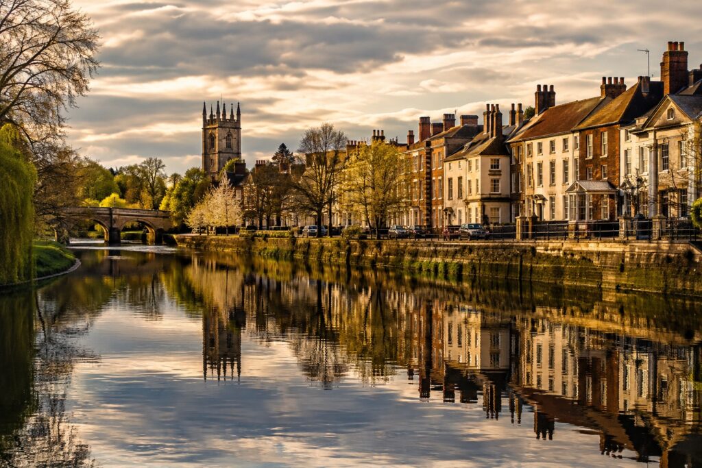
Yarm occupies a distinctive position on a meander of the River Tees. The historic town developed around an important crossing point where the river could be crossed relatively conveniently. Its location gave Yarm an advantage that would remain important for hundreds of years.
The town’s name is thought to have Old English or Old Norse origins associated with an enclosure for catching fish, an indication of how closely the settlement’s early identity may have been connected with the river. Yarm is recorded in the Domesday Book of 1086, although its history extends further back than that record.
The river was more than a geographical feature. It was a source of food, a route for commerce and a natural obstacle that had to be crossed. That combination helped make Yarm strategically useful.
Its position also placed it on routes connecting communities to the north and south. Before modern roads and railways transformed transportation, a reliable river crossing could make an enormous difference to the growth of a settlement.
Yarm as a Medieval Market and Trading Town
One of the most important developments in Yarm’s history came during the medieval period. In 1207, King John granted Yarm a charter allowing it to hold a weekly market. The charter helped establish the town’s long-standing commercial identity.
Markets were central to medieval life. Farmers, merchants, craftspeople and travellers depended on them to exchange goods and services. Yarm’s position beside the Tees and at an important crossing made it particularly well suited to this role.
The town also developed a reputation as a trading centre. Historical accounts describe Yarm as an important medieval port, with the river navigable to the town. Industries associated with the settlement included rope making, brewing, tanning and shipbuilding.
This period helps explain why Yarm developed a relatively substantial town centre rather than remaining a small riverside settlement.
The River Tees connected Yarm to a wider commercial network, while the roads brought travellers through the town. For centuries, these two forms of movement worked together.
The Historic Yarm Bridge
Few structures demonstrate the relationship between Yarm and the River Tees more clearly than Yarm Bridge.
The bridge that stands today has medieval origins. It was commissioned around 1400 by Walter Skirlaw, Bishop of Durham, replacing an earlier bridge believed to have been built around 1200. Historic England lists Yarm Bridge as a Grade II* structure because of its special architectural and historic interest.
The bridge was not merely a convenient way to cross the river. It was an essential part of Yarm’s economic life.
For travellers, merchants and local residents, the crossing connected communities on either side of the Tees. The bridge also had defensive significance at certain points in its history. Stockton Heritage records that its northernmost arch once incorporated a drawbridge, which was used during the English Civil War as part of efforts to control movement across the river.
The bridge itself has also experienced dramatic changes.
An iron replacement was constructed in 1805, partly because concerns had been raised about the effect of the existing bridge on river flow and flooding. The experiment was short-lived: the iron structure became unusable after an arch collapsed in 1806. The older stone bridge was subsequently returned to service after alterations.
The survival of the medieval stone bridge gives modern visitors a tangible connection to Yarm’s past.
Yarm as a River Port
It can be easy to think of Yarm primarily as a market town today, but its history as a port is an important part of its identity.
For a period, Yarm was the highest navigable point on the River Tees and became an important location for moving goods. The river provided a means of transporting commodities before the development of modern highways and railways made overland transportation faster and more practical.
Yarm’s commercial importance was linked closely to its geography. Goods could arrive by river and continue into the surrounding region, while agricultural products and other commodities could move in the opposite direction.
By the 19th century, however, the commercial balance was changing. The growth of Stockton and later Middlesbrough altered the economic geography of the Tees Valley. Historical descriptions from the Victorian period show that Yarm still possessed warehouses and granaries associated with its earlier trading activity, even though the town’s prominence as a commercial port had declined.
This transition is an important part of Yarm’s story. The town did not simply disappear when river commerce declined. Instead, its identity gradually shifted toward road travel, services, residential life and eventually railway connections.
The High Street and Yarm’s Coaching Heritage
The wide High Street is one of the most recognizable features of Yarm.
Its appearance reflects the town’s historic importance as a stopping place for travellers. Before the age of motorways and modern transport, long-distance journeys were slower and required regular places to stop, eat, rest and change horses.
Yarm benefited from its position on important routes between northern towns and cities. The town developed numerous inns and coaching establishments, creating a lively commercial environment around the High Street.
The connection between transportation and architecture is still visible today. Historic buildings, former inns and traditional façades help preserve the atmosphere of the town’s coaching era.
A 19th-century description of Yarm noted its long, spacious main street, inns, market place, town hall, warehouses and other commercial buildings.
Walking through Yarm today can therefore feel like moving through several different periods at once. Medieval trade, Georgian architecture, Victorian transport and modern retail all occupy the same compact area.
Yarm and the Birth of the Railway Age
Perhaps the most remarkable chapter in Yarm’s transportation history is its connection with the development of Britain’s railways.
The George and Dragon Inn in Yarm has a particularly interesting place in this story. According to Yarm Town Council, a meeting held there on 12 February 1821 helped press forward the successful attempt to obtain parliamentary approval for the Stockton and Darlington Railway.
The Stockton and Darlington Railway opened in 1825 and became one of the defining milestones in railway history.
This connection is significant because it demonstrates that Yarm was not merely affected by the Industrial Revolution from a distance. People connected with the town were involved in discussions surrounding one of the developments that would transform transportation in Britain.
Railways would eventually change the role of the River Tees. Where rivers had once provided essential transportation routes, railways could carry goods and passengers more quickly and efficiently over land.
Yarm adapted once again.
The Yarm Viaduct Transformed the Landscape
The arrival of the railway left an enormous physical mark on the town.
The Yarm Viaduct, constructed for the Leeds Northern Railway between 1849 and 1851, stretches for more than half a mile and crosses both the town and the River Tees. It contains 43 arches and was built using millions of bricks.
The scale of the viaduct is striking. It towers above the historic town and creates one of the most distinctive views in Yarm.
Its construction also represents a fascinating moment in local history. The medieval bridge represents an era when river crossings and horse-drawn transport dominated travel. The viaduct represents the industrial age, when railways were beginning to reshape Britain’s economy.
Both structures remain visible today, creating an unusual architectural conversation between medieval and Victorian engineering.
The River Tees runs beneath them, essentially linking these different chapters of Yarm’s history.
Yarm Fair: A Tradition That Has Survived for Centuries
Yarm’s cultural identity is also preserved through traditions rather than buildings.
Yarm Fair traces its origins to the royal charter of 1207. What began as a commercial event associated with livestock and trading has evolved into the modern annual fair held on the High Street.
The transformation from medieval trading fair to modern funfair illustrates how local traditions can survive even when their original purpose changes.
Some ceremonial customs connected with the event continue to reinforce the link between present-day Yarm and its medieval past. The Riding of the Fair and other traditions help turn history into something that residents and visitors can experience rather than simply read about.
This is one of the most interesting aspects of Yarm’s cultural heritage. History here is not confined to museums or archives. It appears in annual events, familiar streets and community traditions.
Religious Heritage and the Friars of Yarm
Religion also played an important role in medieval Yarm.
Dominican friars, sometimes known as Black Friars or Friar Preachers, settled in Yarm around 1286. Their religious community included a friary and hospital that continued until the 16th century. The influence of this period survives in local place names, including Friarage and Spital Bank.
These remnants show how medieval religious institutions could influence the physical geography of a town.
Although the friars themselves are long gone, their presence remains embedded in Yarm’s landscape. Place names can be surprisingly powerful historical records because they preserve connections that might otherwise disappear from everyday memory.
Architecture as a Record of Yarm’s Past
Yarm’s historic architecture is another reason the town has retained such a strong sense of identity.
The historic central area was designated as a conservation area in 1972. A heritage assessment describes the old town as occupying a peninsula created by a bend in the River Tees, with the river helping to define the historic settlement.
The High Street contains buildings representing different stages of Yarm’s development, particularly Georgian and later Victorian influences.
The architecture reflects the wealth that once flowed through the town. Merchants, travellers and professionals created demand for substantial houses, inns, shops and commercial premises.
Rather than being arranged around a grand monument, Yarm’s heritage is distributed throughout the town. The street itself becomes the historical attraction.
The River Tees and Yarm’s Changing Identity
The most important theme running through Yarm’s history is change.
The River Tees first helped make the settlement useful as a crossing and source of resources. It then supported trade and navigation. Later, the bridge became increasingly important for road traffic, while railways eventually created an entirely new transportation network above the river.
The river remained constant while the ways people used it changed.
This is particularly noticeable when looking at the decline of Yarm’s importance as a port. As Stockton and Middlesbrough expanded during the industrial era, the economic centre of gravity along the Tees shifted. Yarm increasingly became known for its historic character and its role as a road and railway settlement rather than as a major commercial port.
That transition is part of what makes the town interesting today. Yarm’s identity was not created during one particular period. It accumulated layer after layer.
Why Yarm’s History Still Matters Today
The cultural and historical significance of Yarm lies in the way its different eras remain visible together.
A visitor can stand on the historic bridge and look toward the railway viaduct. Nearby, the High Street preserves buildings associated with centuries of commerce and travel. Annual traditions recall a medieval market charter, while the surrounding riverside landscape reflects the geography that helped establish the settlement in the first place.
Few places tell their history so clearly through their physical surroundings.
Yarm also illustrates a broader story about northern England. Its development reflects the changing importance of rivers, markets, roads, coaching routes, railways and modern tourism. The town’s history is therefore local, but it is also part of the much larger story of transportation and economic change in Yorkshire and the Tees Valley.
Exploring Historic Yarm Today
For anyone interested in Yarm, North Yorkshire history, the best approach is to explore the town on foot.
Begin around the High Street, where the historic buildings provide an immediate sense of Yarm’s past. Continue toward Yarm Bridge and take time to appreciate its position over the River Tees. From there, look for views of the railway viaduct, one of the town’s most recognizable landmarks.
Walking along the riverside can provide a different perspective. The Teesdale Way passes near Yarm and offers views of the river and surrounding landscape.
The experience is more than a sightseeing trip. Each part of the town helps explain why Yarm developed where it did.
A Town Shaped by Water, Trade and Travel
Yarm’s cultural and historical significance comes from its unusual combination of geography and continuity.
The River Tees gave the town a reason to exist and helped determine its position. The bridge made the crossing practical. The market brought people and commerce together. The port connected Yarm to wider trading networks. Coaching routes brought travellers through the High Street. The railway transformed the surrounding landscape and connected the town to Britain’s industrial expansion.
Through all these changes, Yarm retained its identity.
Today, the town may be better known for its attractive High Street, restaurants, independent businesses and picturesque riverside setting than for its former role as a port. Yet those modern attractions make more sense when viewed against the centuries of history beneath them.
Yarm is not simply a pretty town beside the River Tees. It is a place where medieval commerce, river transport, religious history, coaching culture and Victorian engineering can still be read in the landscape.
That is what makes exploring Yarm, North Yorkshire so rewarding: the past has not been separated from everyday life. It is still part of the town itself.
The written content on this page was generated by ChatGPT.